Historic YVT Maps
These maps come from the YVT company archives. Watch for more maps to be posted in the future.
The first map below was drawn up when the Yakima Valley Transportation Company was formed in 1907. It shows the lines planned by the predecessor Yakima Inter-Valley Traction Company. In applying to the City to obtain Yakima Inter-Valley's franchise, the YVT wanted to reserve the streets and lines shown on this map, so that it could have more flexibility in deciding its final route. Many of the lines shown on this map were never built.
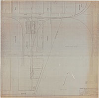
The other maps show the section from the carbarns to the OWR&N connection, the downtown Yakima lines, the Selah line, and the Wiley City line. These maps were all drawn by the YVT, and so they have a high degree of accuracy and detail.
Note: Some of the files are fairly large, so please allow sufficient time for them to fully download.
 |
YVT map for proposed takeover of Yakima Inter-Valley Traction right of way |
| Date: November 14, 1907 |
| File Size: 6.2 MB |
 |
YVT line from carbarn to OWR&N connection |
| Date: June 8, 1911 |
| File Size: 8.4 MB |
 |
YVT City lines from 8th Street to Division (Tieton) |
| Date: Uncertain |
| File Size: 7.2 MB |
 |
Selah Line from Fruitvale to Speyers |
| Date: June 30, 1922 |
| File Size: 17.6 MB |
 |
Yakima to Wiley City |
| Date: June 30, 1922 |
| File Size: 16.7 MB |


